5 great ravine hikes in Toronto
Published May 28, 2025 at 2:04 pm

As summer approaches and the temperatures soar, ravine hikes offer a cool reprieve.
Toronto is blessed with an extensive ravine system — it is said to be the largest in any city in the world. Populated by wildlife and diverse vegetation, many ravines are bisected by streams or creeks and dirt or boardwalk paths.
The Toronto ravine system remains largely undeveloped due to topography and flooding concerns. Most of the system is now designated as parkland.
Most city ravines are easily accessed by subway or bus and within minutes it can feel like you have escaped the busy urban life.
Here are five ravine hikes to try in Toronto:
Moore Park Ravine
This 6.3 kilometre loop trail in the Rosedale area is one of the most popular trails in Toronto, according to AllTrails. This is one of the walks that can feel very far from urban life. The tree canopy covers almost all the trail, great for cooling off on a hot day. The loop passes through Evergreen Brickworks, which has a year-round farmer’s market on Saturdays.
This loop can be accessed from several points and is a short walk from Rosedale Station.
Cedarvale and Nordheimer Ravine Trail
This is an approximately seven kilometre out-and-back route through the midtown area of the city. The start of the trail can be accessed from Roycroft Park, about a ten-minute walk from Dupont Station. The route dips into a forested area with “one of the finest stands of old Oaks in the city,” according to the City of Toronto. Nordheimer ends at St. Clair Avenue West, near the subway station.
Walkers can continue on, past the Loblaws to second part of the trail in Cedarvale Park. Just east of Bathurst, there is a large cattail wetland. This ravine was largely clearcut during the construction ahead of the proposed Spadina Subway in the 1970s, which was cancelled. The trail ends a few blocks south of Eglinton Avenue.
Glen Stewart Ravine
A hidden gem in the city, the Glen Stewart Ravine is small but enchanting with wooden boardwalks taking hikers through the forest. A stream runs alongside the trail surrounded by steep wooded slopes. Hikers can continue on through to the trails along Lake Ontario to the historic Leuty Lifeguard Station.
The ravine can be a longer walk from Main Street Station or drivers can park near Kingston Road and Main Street to access the trailhead.
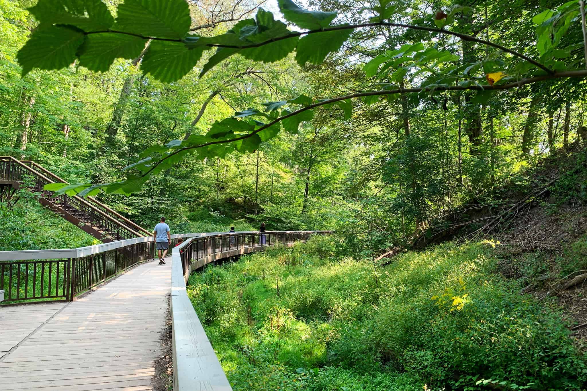
Glen Stewart Ravine Photo: Karen Longwell
Sunnybrook, Sherwood and E.T Seton
A series of trails hug the Don River through ravines, parks and forested areas. There is a mix of paved and dirt paths, which are shared with cyclists. Shorter loops are around four to five kilometres.
Hikers taking the TTC can head out from Lawrence Station to the beautiful Alexander Muir Memorial Garden and continue south along trails to Blythwood Ravine Park, then Sherwood Park and east to Sunnybrook Park. E.T. Seton is south of Sunnybrook.
Rouge National Urban Park
Located near the Toronto Zoo, this park was originally formed in 1995 in partnership with Toronto, Markham and Pickering and the Toronto and Region Conservation Authority. In 2015, it became part of the Parks Canada system, and is the largest urban protected area in North America. It is still free to visit.
There are over 10 different picturesque trails to choose from ranging from one kilometre to 10 kilometres.
Hikers can see the Rouge and Little Rouge rivers, wander through mature forests, past farm fields and emerge at the southern end of park to Lake Ontario. This park is also spectacular in the fall.